The Eau d’Heure Walking Trail

A new “leisure walkway” along the Eau d'Heure river
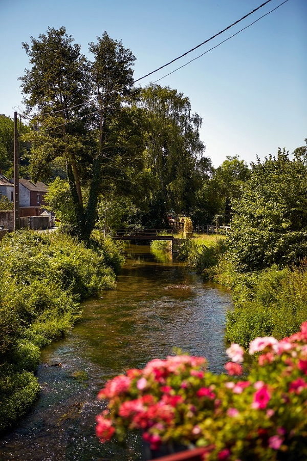
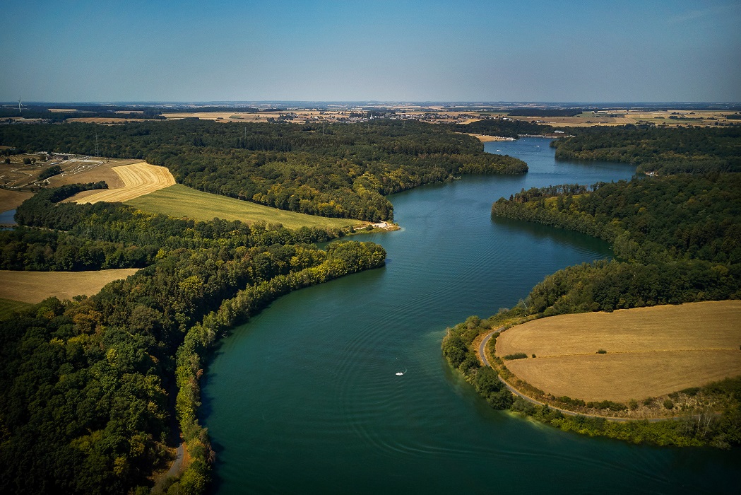
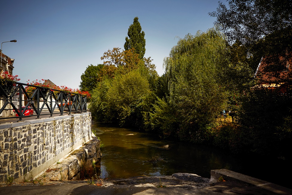
Stretching over 37 kilometres, the Eau d’Heure river winds its way through two provinces (Namur and Hainaut) and 6 municipalities, from its source at Cerfontaine, all the way through to where it meets the Sambre in Charleroi. A truly natural corridor interacting with those who live along it, it belies a wealth of natural resources, and borders on several sites of great biological interest.
A study aiming to develop a walking path alongside the river has recently got underway. The initial conclusions and recommendations are expected to emerge in the summer of 2021.
An ambitious project for the environment and tourism
This new project to create a river run is part of broader touristic, economic and environmental developments taking place in the area. This is a wonderful opportunity to take a vision shared by the citizens of the Charleroi Metropolitan Area and translate it into a real-life project.
The path aims to serve as:
- An itinerary for walking and discovery;
- A complement to new forms of gentle and active mobility, joining the existing network (TEC and SNCB networks, walking trails, hiking, Ravel and Pre-Ravel networks of public footpaths…);
- A boost for tourism and the local economy, helping to attract promising projects to the Metropolitan Area.
Another objective is to showcase:
- The richness of the environment and the countryside across the Charleroi Metropolitan Area;
- The green and sustainable image of the area (short supply chains, local produce and regional specialities …);
- Natural heritage and preservation of biodiversity.
A territorial project
The territorial dynamics set in motion by the Conference of Mayors through the ‘territories project’ resulted in a list of 5 countryside “plateaus” with specific identities highlighting the river system’s structural potential in terms of gentle mobility, economic and tourism development as well as ecological links.
A unifying project
What makes this project stand out is the fact it goes beyond the municipal level. The project involves 6 municipalities, all intersected by the Eau d’Heure: Cerfontaine, Froidchapelle, Walcourt, Ham-sur-Heure/Nalinnes, Montigny-le-Tilleul and Charleroi.
The aim is to make participation a central part of the process and ensure that as many people as possible are involved in the project’s progress. The project is intended to reach out to elected representatives as well as to local stakeholders and people directly affected by the subject of the project (residents, farmers, fishermen, tourist information offices, organizations and associations…).
The project’s Steering Committee will include the Mayors and representatives from the 6 municipalities, the CITW, the General Commission for Tourism, IGRETEC and the BEP. It shall be chaired by Jean-Philippe Lebeau, President of the Contract of the River Sambre and Affluents.
A multifaceted project
The consortium “Réservoir A – Architectes SRL”, selected to carry out the project, will centre the work around 3 major axes:
1. Territorial and tourism diagnostics
This section shall consist of drawing up a full assessment of the territory looking at three major components:
- Development of the territory, countryside and biodiversity;
- Tourism and the economy: analysing what tourist attractions already exist and where the region currently stands;
- Mobility
For each subject area the project will hone in on the challenges and opportunities, constraints, points of attention, and recommendations.
2. Positioning strategy and development vision
This section shall comprise:
- The proposing of an identity (narrative, staging, graphic charter…);
- The definition of a precise route based on several scenarios;
- The identification of sites to develop, showcase and renovate;r
- The list of touristic points and actions to be taken all along the route.
3. Action programme
This chapter shall set out all the steps required to implement on the ground the developments, products and other projects identified within the strategy.